Hiking Table Mountain in Teton Canyon
- CJ Wolf
- 2 days ago
- 3 min read
Fast Facts:
Base Elevation: 7,004
Peak Elevation: 11,084
Hiking Elevation Gain: ~4,300
Distance: ~8.5 miles (my Strava paused)
Elapsed Time: 5:27 hours
Date: July 3, 2026
Strava: link
I had previously summited the Grand Teton from the Jackson side, and one of the highlights of that climb was camping on the saddle between the Grand and Middle Teton. From our campsite, we enjoyed spectacular views west across the Teton Valley (Driggs, Idaho), and I often wondered if there was a way to reach that area from the Idaho side.
While visiting my sister-in-law in Driggs, I decided to find out. After researching hikes in Teton Canyon, I discovered that although it is possible to hike toward the saddle, the most popular hike in Teton Canyon that offers the best view of the Grand is Table Mountain.
Getting There
From Driggs, head east toward Grand Targhee Resort on Ski Hill Road. About six miles from town, turn right onto Teton Canyon Road. Follow the well-maintained gravel road for approximately 4.4 miles to the end of the canyon, crossing the bridge just before reaching the trailhead parking area. Continue to the second parking lot at the very end of the road.
At the east end of the parking lot, you'll see a sign for the South Teton Trail. Don't take that trail if your destination is Table Mountain.

You'll see a bathroom facility on the left side of the parking lot and just to the left of that you'll see a small sign for Face Trail. This is the trail that you want to take.


I recommend starting this hike early in the morning. The lower portion of the trail faces east, so you'll enjoy plenty of shade before the sun climbs higher. The climb begins immediately, so wear fewer layers than you think you'll need—you'll warm up fast.
I have a simple rule of thumb: if a trail gains more than 1,000 feet of elevation per mile, it's steep. This hike shatters that benchmark, climbing approximately 2,300 feet in the first mile alone.
The trail isn't technically difficult, but it is relentlessly steep. During the first 0.4 miles, you'll gain nearly 1,100 feet of elevation, with sustained grades in the mid-30% range.

The first half mile offers stable hiking with firm rocks.


At .5 miles, there is a scenic overlook pullout that offers the first glimpse of the upper Teton Canyon.

The trail eases up for about 0.2 miles and then grade quickly steepens again, exceeding 40% in places. The footing also becomes looser, with more rocks underfoot and a series of short, tight switchbacks.

At about 0.8 miles, you reach the ridgeline, and the trail emerges from the trees into open alpine terrain, the grade eases, and the expansive views begin to unfold in every direction. Most importantly, the hardest part of the climb is now behind you.
For the next two miles, the trail climbs at a much more moderate grade—generally in the teens—making for a pleasant traverse across the broad ridge toward Table Mountain.

At the 2 mile point, you will get your first glimpse of the mighty Grand!

At around 3.5 miles, you encounter some scree but only for a short while.

The final .3 of a mile, it starts to get steep again (30 degrees).

As you approach the summit, there is a brief non-technical scramble and then it is over.

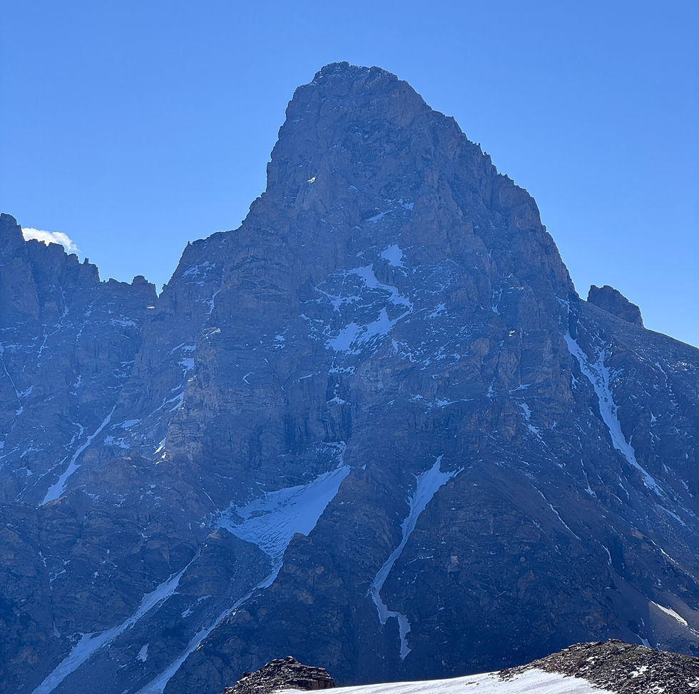
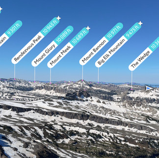
The summit of Table Mtn offers spectacular views of the Grand Teton along with many other peaks like Mount Owen, Middle Teton, South Teton and Mount Moran.


On the return, some hikers choose to extend the hike by making a loop via the North Teton Trail. I opted to retrace my steps instead, but the alternate route reportedly adds about an additional 5 miles. The turn off for the North Teton is well marked.


Comments