Kessler Peak Summit
- CJ Wolf
- Jun 22, 2021
- 4 min read
Fast Facts:
· Summit: 10,403
· Elevation Gain: 2,895
· Distance: 5.6 miles (without the wrong turns)
· Moving Time: 3:29
· Date: June 20, 2021
· Companions: Fletcher and Cady

Since it was Father’s Day and the summer solstice, I thought there was no better way to celebrate the day than to bag a peak with my wife and hopefully one of my sons. In order to make the hike more enticing to my kids and my wife, I selected a shorter hike (less than 8 miles) and a lower altitude summit (below 11,000) but Kessler Peak still ranked “difficult” on one my Wasatch hiking maps which my wife noted. My 3 teenage sons profess that they don’t like to hike but my youngest rallied to the call on this special day.
Kessler Peak is located in Big Cottonwood Canyon and is really the only summit peak that doesn’t run along the Big and Little Cottonwood ridge line. As such, it is a shorter summit hike than other BCC peaks like Twin Peaks, Dromedary or Sunrise Peak. Although this hike is relatively short at ~5.6m miles, it makes up for it in steepness going from 7,508 at the TH to 10,403 which is a gain of about 1,050 per mile and anything over 1,000 ft / mile is steep in my book. What is appealing about this hike is that it is not crowded as there are no trails signs and most of the people hike towards Donut Falls plus it is cooler than most trails due to its northern aspect. In addition, it is a good reconnaissance hike to checkout some of the iconic ski runs like God’s Lawnmower and Catcher’s Mitt.
To get to the trailhead, drive 9 miles up BCC (Highway 190) and then turn right at the Donut Falls parking lot which is the big parking lot with the only street light in BCC. You can park right off Highway 190 but if you get there early, you can drive .8 miles to the actual trailhead. The Kessler Peak route shares the Donut Falls TH so follow signs for Donut Falls from the parking lot.

You will quickly come upon a small bridge which you will cross and then you will see a trail sign for Donut Falls BUT don’t follow this trail. We made the mistake of taking this trail and had to turn around. Go beyond this sign about 20 feet and it will take you to a jeep road.

Take a left on the jeep road and after about 200 yards- look for a narrow, steep trail on the right. As I said above, there are no trail signs for Kessler and it is very easy to walk past this TH as it looks more like a stream runoff than an actual trail. It is a very tight single track that is overgrown so at first you might think it is not the right trail. But once you are on the trail, the path to the summit is very straightforward.
The bottom section is steep and after a few minutes of climbing the top of Kessler comes into view and I thought my wife and son were going to kill me as the summit looked very daunting and far off.

The three of us stayed together for about the first 1.5 miles and then my wife said to go ahead. At about the 2 mile point another party was descending and my son, Fletcher, asked them how much far (should never ask that question) and they said we were just over halfway when in fact we were about 70% of the way to the summit. My son’s enthusiasm was immediately deflated and he said he was turning around. I bribed him with some Welch’s fruit snacks and applied a little Father’s Day guilt which persuaded him to march on.
When you think the trail can’t get any steeper, it does. Between the 2nd and the 3rd mile is the steepest with a gain of 1,253 feet. At about 9,800 feet you come to a dilapidated hut that was once shelter for miners and just beyond that is the first of two mines. The first one is actually quite deep and you can venture into the tunnels.


The 2nd mine looks more like a big hole and is very close to the ridge at 10,100 feet.

The trail gets quite loose around 10,000 but it is not technical and there are no major drop offs to be concerned about. Once you get to the ridge, you are treated to some awesome views up BCC to the east and you can see Solitude, Brighton and Clayton Peaks. At this junction, you are tempted to scramble up the rocky ridge line as you think the peak in view is the actual summit but don’t be misled by this false summit.

Yes, you are very close and only have about 200-300 feet of elevation to go but stay to the right and follow the more defined trail. This route will be quicker and is much easier. At this point, Fletcher was motivated to beat me to the summit so he darted off and captured the summit ahead of me which was a nice reward for him. I told Fletcher that summiting with one of my sons is the best Father’s Day gift one can ask for. There are so few joint accomplishments that you can celebrate with teenagers. He probably doesn’t appreciate it now but hopefully he will look back at our summit photo one day and realize how special a moment it was (at least for me).
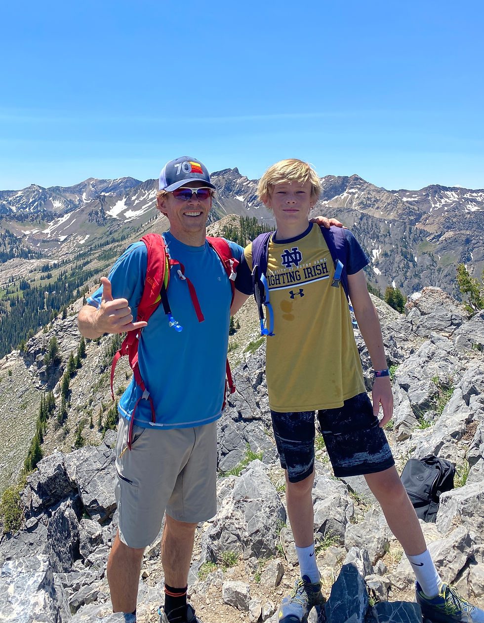
Once you reach the summit, all of the pain goes away and you a rewarded to an amazing 360 degree view of some of the most prominent peaks in the Wasatch. To the south you see Superior and the Snowbird tram, to the north you see Mount Raymond and Gobblers and to the west you see SLC and the Great Salt Lake.
We got to the top in just over 2 hours with about 10 minutes of stopping and we made two wrong turns at the beginning that added about .3 miles and 20 minutes. Total round trip was 3.5 hours.
Happy summiting!


Comments