Skiing Mt. Superior's South Face
- CJ Wolf
- May 2, 2021
- 4 min read
Updated: May 11, 2021
Base Elevation: ~8,700
Summit Elevation: 11,040
Elevation Gain: 2,340
Round Trip Distance: 4.3 miles
Total Time: 5:13
Date: April 23, 2021
If you have ever skied Snowbird or Alta and looked across the canyon to the east- you would be staring at one of the most impressive peaks in the Wasatch range called Superior. I think the name says it all- this peak is truly superior. Not only is this peak superior but it is intimidating and yet inviting at the same time. I hiked this peak back in 2018 and the goal was to one day ski it but the conditions have to be right as the avalanche risk on this peak are considerable.
I got a text later at night from a buddy saying he was thinking about hitting Superior the following day and it took me all of 2 minutes to contemplate it and say yes despite being nervous about the mission. Superior is one of the “50 classic ski descents” so it is the real deal.
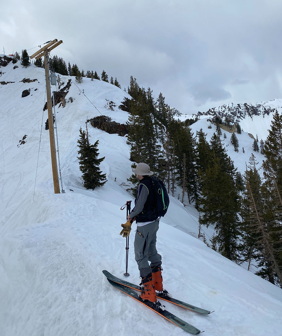
It was April 23rd 2021 and LCC got 20” the week before so the snowpack had time to settle thus reducing the avy risk. We got to the trailhead around 8 AM with the goal of summiting and then skiing around 11 which should provide enough time for the south facing peak to thaw out and turn to corn. We parked by the Our Lady of Snows Center (my kind of religion) and headed towards Cardiff Trail. You will see a skin track which will lead you up the pole line to Cardiff Pass.

This section is relatively flat and easy going. It took us about an hour to get up to Cardiff Pass which is at about 10,000 and about 1,300 of elevation gain.
At this point we thought we only had another hour of climbing but we were sadly mistaken. From Cardiff Pass, we headed west towards Cardiff Peak and we decided to go around Cardiff Peak to the south which we later realized wasn’t the fastest route because 4 other skiers that were behind us passed us as they went over Cardiff Peak. Furthermore, going around Cardiff Peak was quite sketchy due to rocks, cliffs, fallen trees and limited snow.
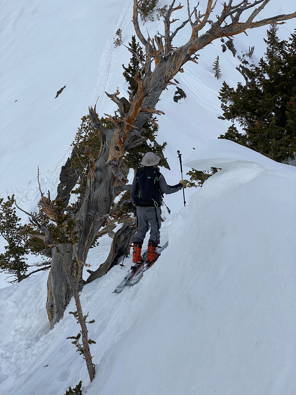
Going around Cardiff took us about an hour and we didn’t gain any elevation. Once we got back on the ridgeline, it was a long slog on your skins with several steep switchbacks that I didn’t think I was going to be able to pull off with my skis on. Once we got to about 10,500, it became too steep and rocky to continue on skins so we ripped them off and began the tight bootpack. This bootpack will most certainly test your mettle as it is quite technical with numerous knife edges. I had my skis strapped to my backpack which is highly advisable as it allows you use both poles while hiking and eventually hands for climbing. However, Sean didn’t strap his ski to his backpack because one of his shoulders was injured so he wanted less weight on that shoulder.

There are a few sections where the trail is only about a foot wide and the drop off on either side is consequential. My strategy in these situations is to look where you want to go and not where you don’t want to go (so don’t look down). There are a few false summits to be prepared.
Once you reach the summit- the views are astonishing especially of Monte Cristo to the west. The town of Alta looks like it is miles away now that you are at 11,040.


We were anticipating a sunny spring day but when we finally got the summit around 11:30, the wind picked up and it started snowing. We debating waiting until it passed but we elected to get on as we were concerned that the snow would get to soft. Right before we dropped in, Sean’s poles blew off the summit but luckily they didn’t slide down the entire hill. We put on our skis at the summit and skied around the top cornice to get Sean’s poles. Since neither one of us had skied Superior before, we dint’ know the best route for this time of year which would be costly. We should have skied to the skier’s right to avoid the chutes on the left that became cliffed out but we got sucked to the left. Now that we were on the skier’s left side of the south face, we were presented with two steep chutes and you couldn’t tell which one was better or if either one of them had a skiable exit.
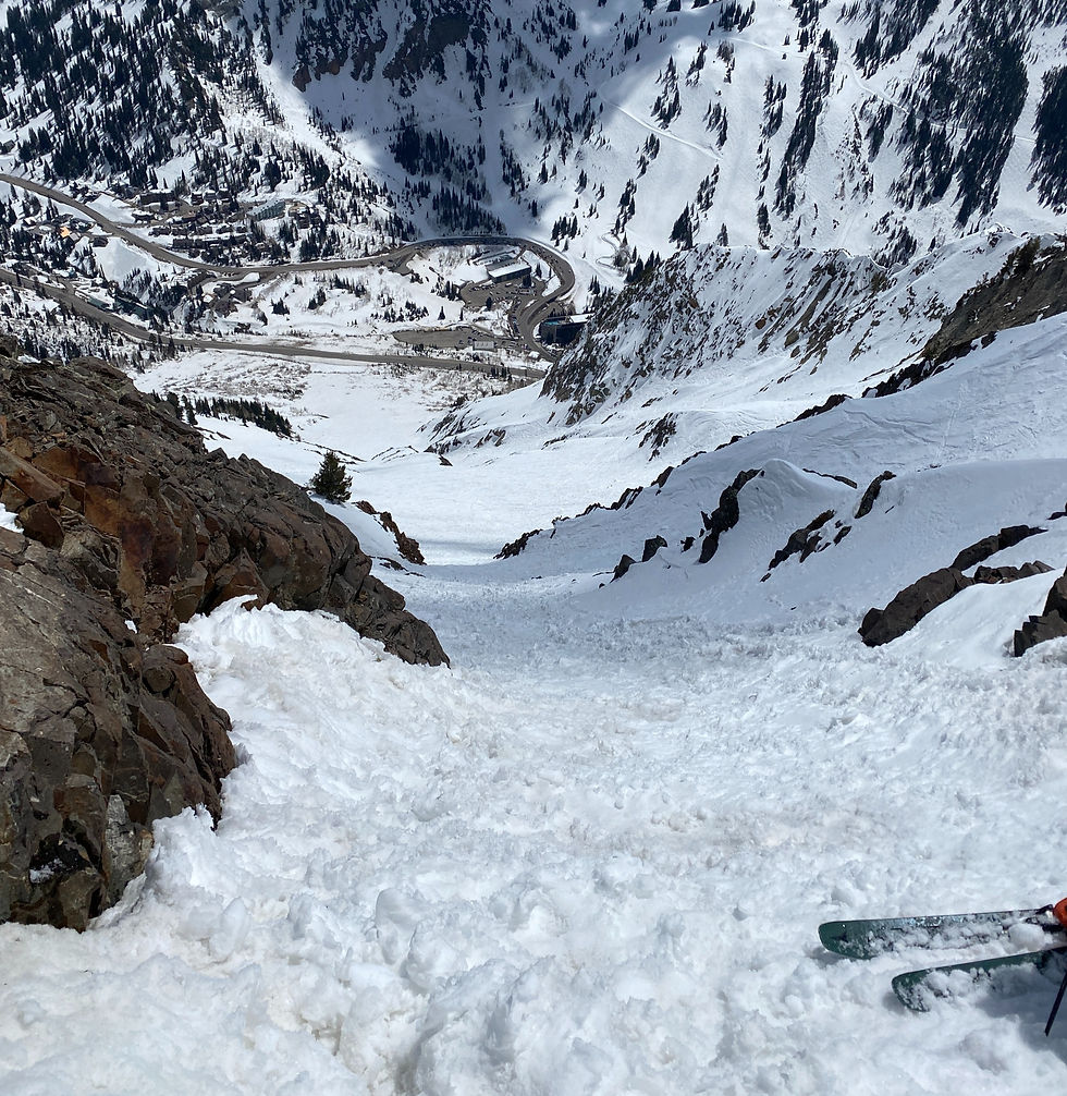
We took the far left chute thinking it had an exit but after dropping about 150 yards down a tight couloir, we soon realized that it terminated into a large rock ban that was not skiable.

At this point, we are too far down the chute to turn around so we elected to remove our skis which is usually highly unadvisable. We began our down climbing with skis in hand and facing the mountain. Sean moved through this section much faster than I did as I was overcautious as I didn’t want to cause an accident that required a mountain rescue. Nobody wants to be the guy calling for a heli evacuation. Each step sent rocks and snow chunks down the mountain but we ultimately got through this 200-300 vertical section.
It was now close to 1 pm and the snow was totally cooked. There had been a wet slide in this area since the last storm so there were big snow chunks and with the freeze/thaw the last few days- the snow was like mega popcorn chunks (not smooth). My only goal at this point was to get to the bottom without an injury so I would take very long Z turns across the entire mountain.
We finally made it to the bottom around 1:30 or 5 hours and we were relieved to be off the mountain but certainly disappointed in the conditions and our choice of lines. There will most certainly be a redemption effort in the future to ski this amazing face properly.
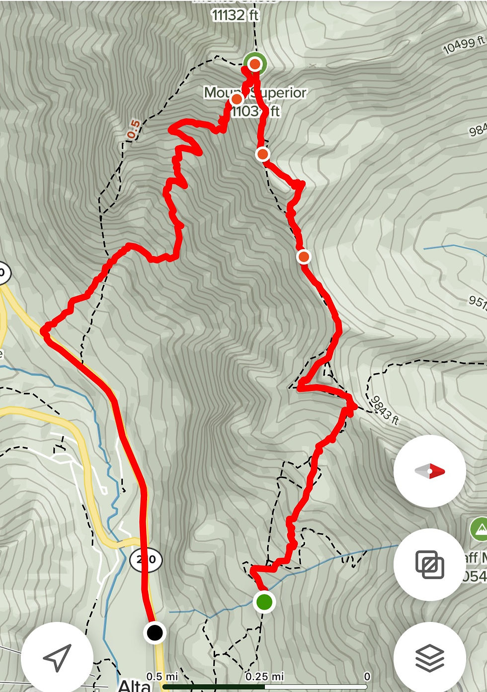
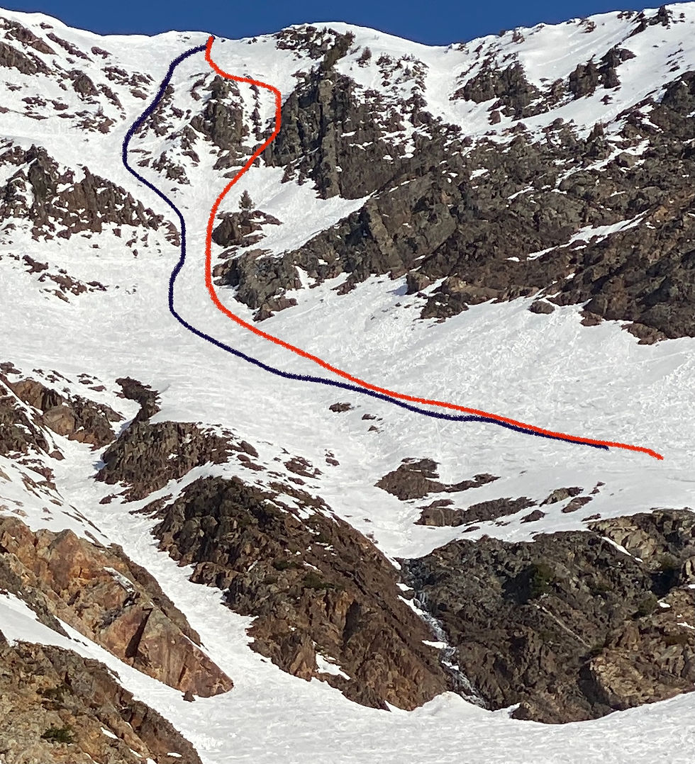
Here is a picture outlining the route we took in red and the route we should have taken in black. Ooops.


Comments